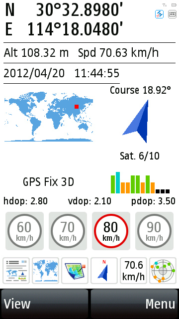
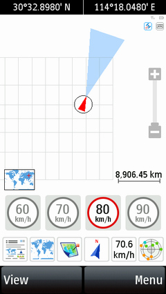
- Summarized view shows all your GPS
information at a glance.
- Digital speedometer with customizable
speed alarms.
- Twin-mode digital compass with destination
information display.
|

GPS Information |
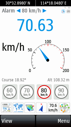
Speed Display with Alarm |
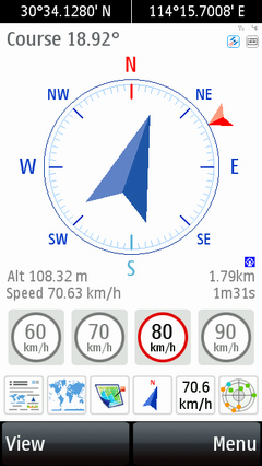
Digital Compass &
Destination Info |
|
 |
| |
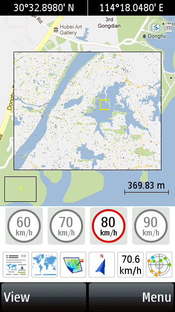
- World map view displays your location
anywhere in the world with free-scale zooming.
- Free to use any map image (e.g. Google
Earth satellite/aerial photos) for real-time moving map
navigation. View your location, moving direction, track
route, POI ...
- Advanced caching technology supports
fast map operation & ULTRA LARGE map image.
- "Go To" navigation function
can guide you all the way to your destinations, there's
dest. distance, TTA, direction guider, proximity alert...
almost everything you want!
- Customizable track logger can record all your movement
in Google KML, GPX or CSV format for later replay or analysis.
|
World Map |
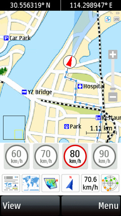
Real-time Map Navigation |
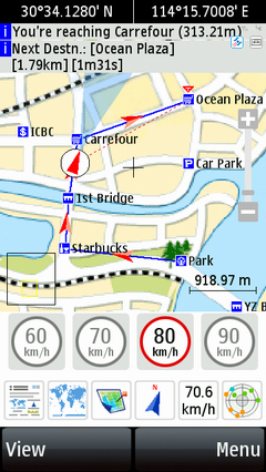
"Go To" Destinations |
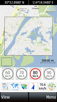
Working Example of
a 6000*4800 pixels Image Map |
|
| |
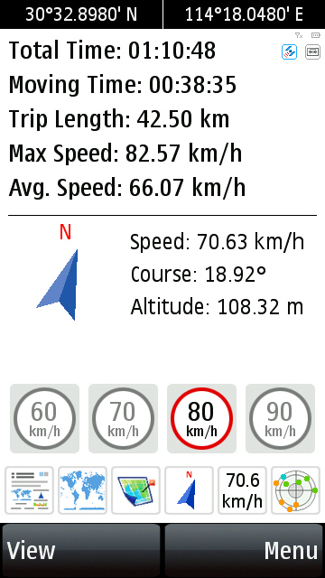
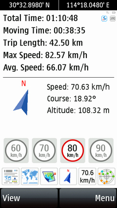
- Trip statistics with information like
Moving Time, Trip Length, Max Speed and etc.
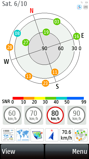
- Graphical satellites state display with detailed statistics.
|
Trip Statistics |

Satellite Graph |
|
| |
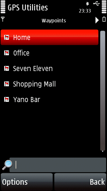
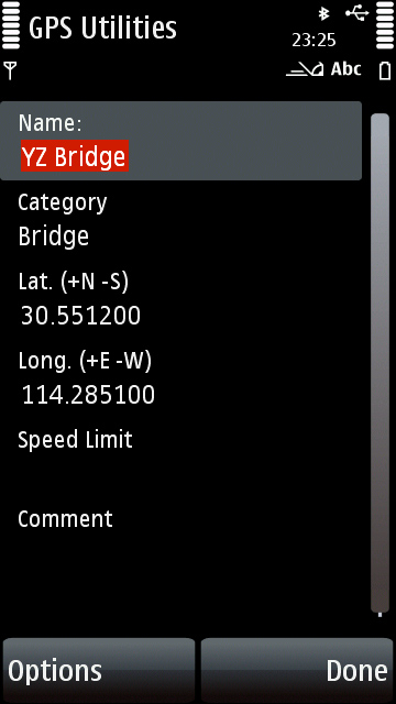
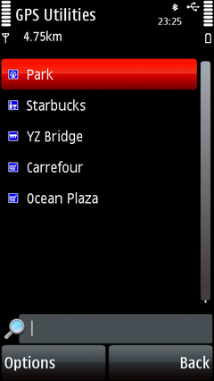
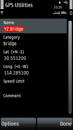
- Waypoint & POI Manager and GeoPoint
Editor helps you manage waypoints, POI and destinations
easily.
- Fully support GARMIN .csv POI format with 30+ pre-defined
POI icons.
|

Waypoint & POI Manager |
Edit Destination List |
GeoPoint Editor |
|
|
| |
- Friendly interface design with night
view support, switch views at single finger touches.
- Advanced "5 Seconds Average"
and "Kalman Filter" NMEA processors for high
precision navigation.
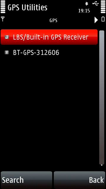
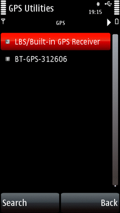
- Works with any Bluetooth GPS receiver
that supports the standard NMEA0183 protocol. Auto detects
Bluetooth GPS receivers.
|
Program Options |
|